Wadelynn Geospatial, LLC provides a wide range of Hydrographic Surveying services. We have over 13 years of experience performing hydrographic surveys on rivers, lakes, ponds, ports, canals and oceans. Our range of experience qualifies us to handle projects of any size. From a large seafloor mapping project to a small remotely accessible pond, you can depend on us for your underwater needs. Most importantly, we understand the end use of hydrography data and we are committed to providing the most accurate advanced surveys possible that are USABLE.
Hydrographic Surveying
Hydrographic Surveys
- SINGLE & MULTI-BEAM SURVEYS
- SIDE SCANNING / UNDER WATER CAMERAS
- SUB-BOTTOM PROFILING
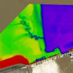
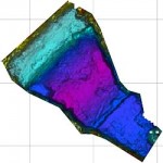
- Hydrographic-Bathymetric Surveys
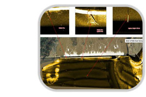
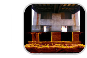
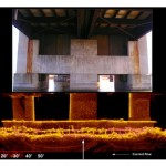
- Bridge Inspection / Scour Assessments
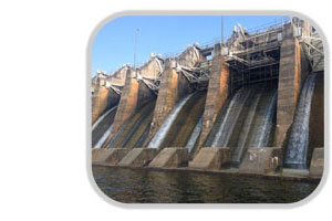
- Dam Inspections / Scour Monitoring
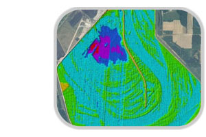
- Available Volume Calculations
- Waste Pond Remaining Life Studies
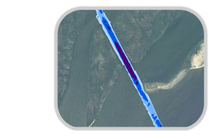
- Channel Condition Surveys
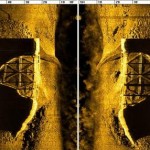
- Debris Mapping
- Pre / Post Dredge Monitoring
- Structure Inspections
- Post Construction Surveys
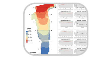
- Sedimentation Surveys
- Aquatic Habitat Studies
Hydrographic Survey Equipment
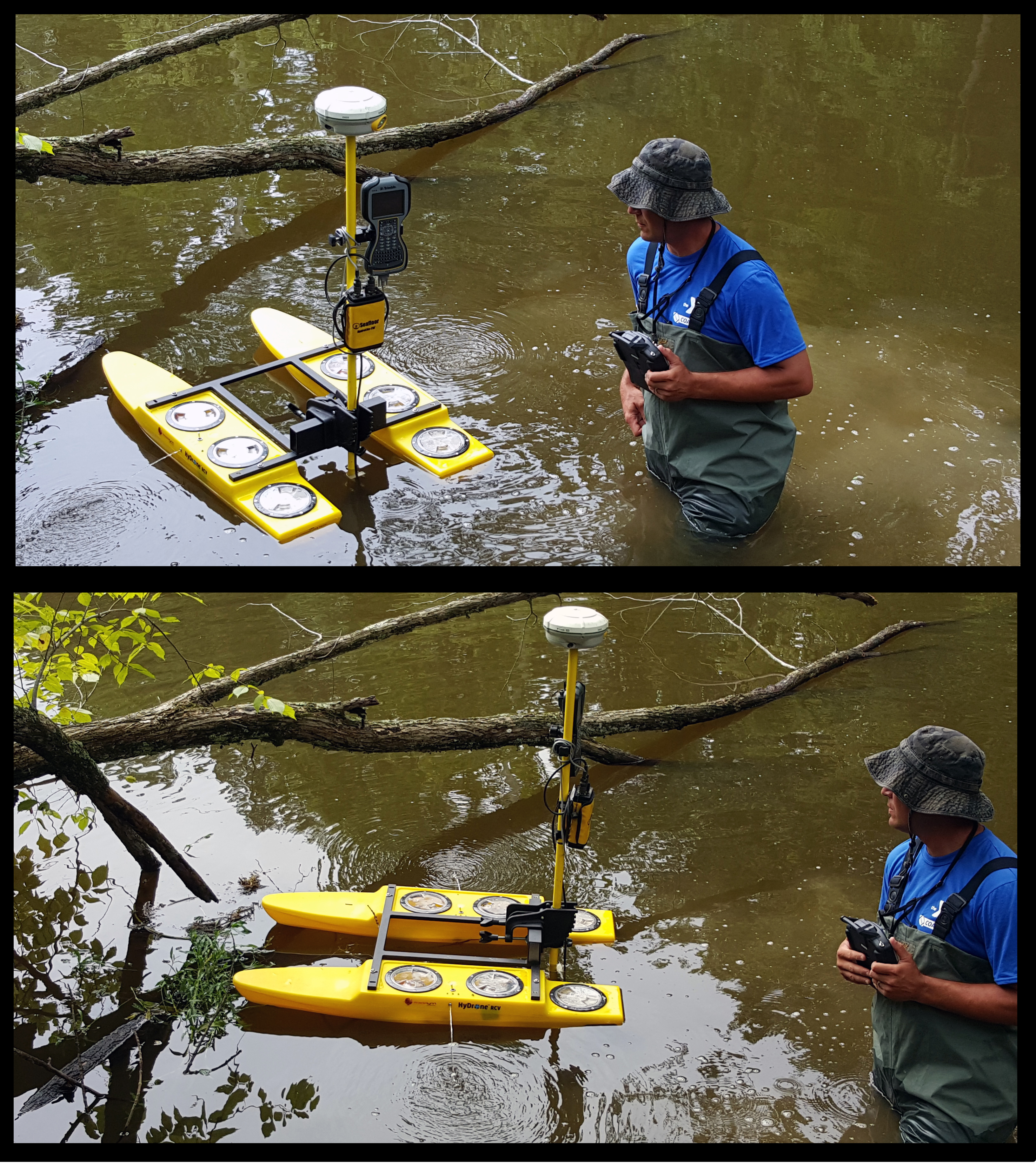
- Industry-leading GNSS Trimble positioning (VRS, RTK)
- Trimble DGPS Receiver
- Trimble Robotic Total Station
Vessel Motion
- Coda Octopus F175-T2
Single-Beam Echosounder
- HydroLite-TM with Sonarmite BT Echosounder (200 kHz transducer)
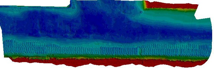
Multi-Beam & Side Scan Sonar
- EdgeTech 6205 Swath Bathymetry & Side Scan Sonar –See Details
3D Underwater Imaging
- Coda Echoscope 3D Sonar – See Details
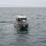
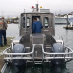
-24’ Custom Aluminum Survey Boat – Twin 200 HP Yamaha Fourstrokes
-24’ Catamaran Survey Cruiser (aluminum hulls) – 90 HP Mercury Fourstroke
-12 & 16’ Johnboats (aluminum hulls) – 25 HP Suzuki Fourstroke
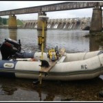
-10’ Zodiac Inflatable – 25 HP Suzuki Fourstroke
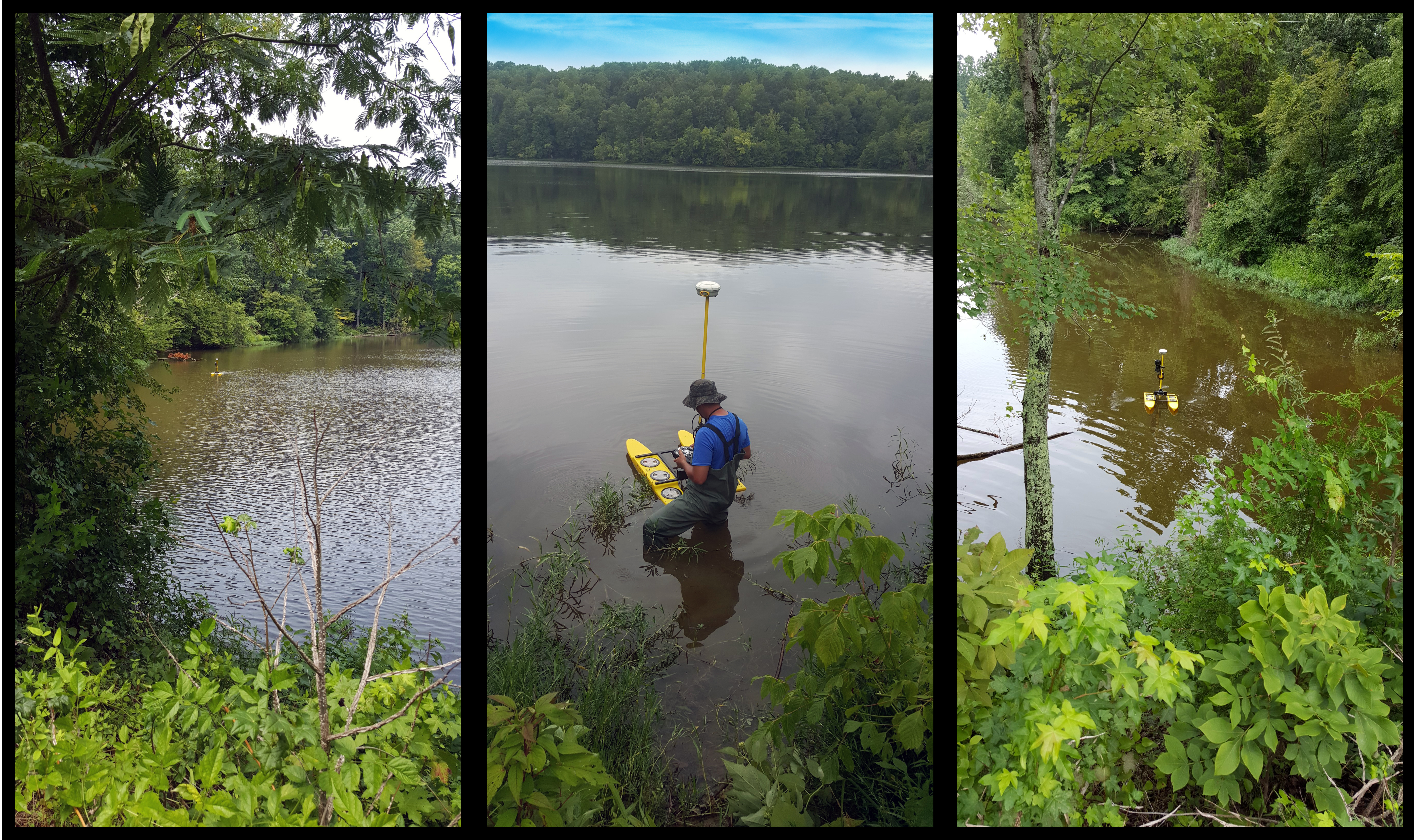
-Remote Controlled Survey Boat
Software
-HYPACK / HYSWEEP (Hypack, Inc.)
-AutoCAD / AutoCAD 3D (AutoDesk, Inc.)
-ArcGIS 3D Analyst (ESRI)
Recent Applications